
Introduction to Site Exploration VR with Terrain Analysis
Relevant case studies


 Author: Spark Team
Introduction to Site Exploration VR with Terrain Analysis
Introduction to Site Exploration VR with Terrain Analysis
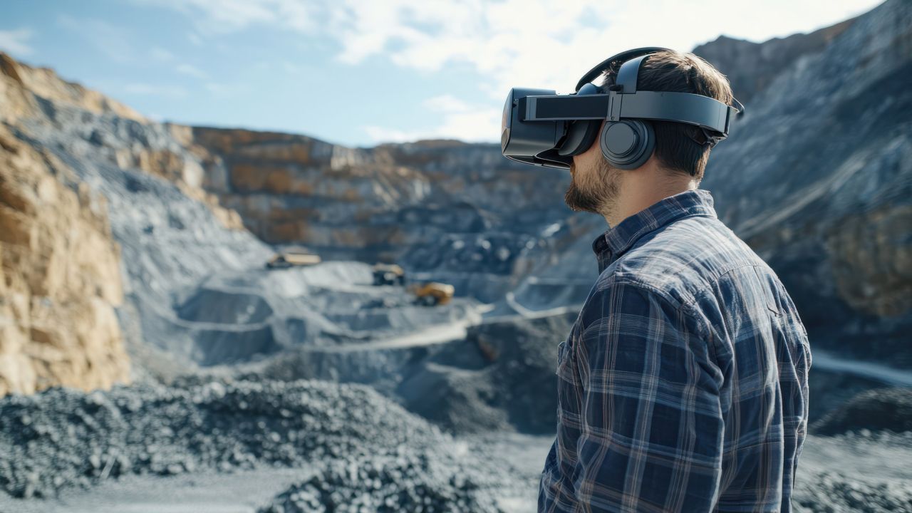
In construction, urban planning, and environmental assessment, understanding the terrain is essential for making informed decisions about site development. Virtual Reality (VR) provides an innovative platform for site exploration and terrain analysis, enabling professionals to visualise and interact with 3D representations of landscapes. Spark Emerging Technologies specialises in developing VR solutions that enhance site exploration, allowing teams to analyse terrain effectively and optimise their planning processes.
Benefits of Site Exploration VR with Terrain Analysis
Implementing VR for site exploration and terrain analysis offers numerous advantages that improve project outcomes:
Immersive Visualisation: VR allows users to experience sites in a 3D environment, providing a realistic understanding of topography, vegetation, and other geographical features.
Enhanced Terrain Analysis: Users can interact with terrain data, such as elevation changes and slope analysis, to make better-informed decisions about site suitability and design.
Real-Time Data Integration: VR can incorporate live data, such as geological surveys and environmental assessments, providing a comprehensive view of site conditions.
Improved Collaboration: Teams can use VR to visualise and discuss site conditions together, fostering collaboration and communication among stakeholders.
Risk Mitigation: By analysing terrain features in VR, professionals can identify potential risks and challenges early in the planning process, reducing costly revisions later on.
Real-World Applications of Site Exploration VR with Terrain Analysis
Construction Planning: VR can help construction teams assess site conditions, visualise infrastructure placement, and evaluate potential challenges before breaking ground.
Urban Development: City planners can use VR to analyse terrain and vegetation when designing parks, roads, and other urban features, ensuring sustainability and accessibility.
Environmental Assessments: Environmental consultants can visualise and analyse terrain data to assess impacts on ecosystems and wildlife during site development.
Infrastructure Projects: Engineers can use VR to evaluate terrain for infrastructure projects, such as roads and bridges, optimising designs based on site conditions.
Disaster Management: VR can assist emergency planners in understanding terrain features that may affect evacuation routes or resource distribution during disasters.
How Spark Emerging Technologies is Leading VR Solutions for Site Exploration and Terrain Analysis
At Spark Emerging Technologies, we specialise in developing immersive VR solutions that enhance site exploration and terrain analysis for various industries. Our interactive applications provide professionals with the tools they need to visualise and analyse sites effectively. By collaborating with organisations, we create tailored VR experiences that address specific challenges in site planning and development.
Addressing Key Challenges with VR for Site Exploration
User-Friendly Interfaces: Our VR applications are designed with intuitive controls, ensuring that users can easily navigate and interact with site and terrain simulations.
Integration with Existing Systems: We ensure our VR solutions seamlessly integrate with existing Geographic Information Systems (GIS) and project management software for comprehensive analysis.
Data Privacy and Security: Protecting sensitive site data is essential; we implement robust security measures to safeguard information collected during VR interactions.
Scalability Across Various Projects: Our VR solutions are adaptable, allowing for deployment across different types of projects and terrain analysis needs.
Case Study: VR for Construction Site Planning
A construction firm partnered with Spark Emerging Technologies to implement VR solutions for site exploration and terrain analysis. The VR application allowed teams to visualise site conditions, assess terrain features, and identify potential challenges. As a result, the firm reported a 25% reduction in planning time and improved collaboration among stakeholders, leading to more efficient project execution.
The Role of VR in Advancing Site Exploration
Site exploration VR with terrain analysis is transforming how professionals approach planning and decision-making in construction and environmental assessment. By providing immersive experiences that enhance visualisation and interaction, VR fosters a proactive approach to site analysis and project development. This innovative method not only improves operational efficiency but also empowers teams to take control of their planning processes.
Future of Site Exploration VR with Terrain Analysis
As VR technology continues to evolve, the potential for site exploration and terrain analysis applications will expand significantly. Spark Emerging Technologies is committed to enhancing our VR solutions, anticipating more sophisticated applications that empower professionals to optimise their site planning strategies. The future promises increasingly interactive and data-rich VR experiences that will play a crucial role in effective site development.
Conclusion
Site exploration in VR with terrain analysis offers transformative solutions for improving planning and decision-making in various sectors. Spark Emerging Technologies provides cutting-edge VR applications that enable professionals to visualise and analyse terrain effectively, fostering a culture of operational excellence. Discover how our VR solutions can enhance your site planning processes—contact Spark Emerging Technologies for a demo today.
Contact Us:
Interested in optimising your site exploration and terrain analysis with VR? Contact Spark Emerging Technologies to schedule a consultation and learn how our solutions can benefit your organisation.
© 2026 All Rights Reserved | Company Reg No. 05327622 | Spark Emerging Technologies Limited